|
As you know, we are racing our geocaching Travel Bug around the National Parks. So far, it's 2-1 to us, as May has only visited the Brecon Beacons where we dropped her off. But we were really excited to hear that she was picked up yesterday and will be travelling towards the Pembrokeshire Coast next week - coincidentally where we have just returned from. It finally feels like the race is on!
If you're interested, you can track May's whereabouts by visiting www.geocaching.com/track/ and using the Tracking Code TBKNEK.
0 Comments
The Brecon Beacons National Park was established in 1957 and was the 10th National Park created in Britain. It covers 520 square miles and stretches from the Black Mountain in the west, across Fforest Fawr and the Brecon Beacons, to the Black Mountains in the east (note the plural!). Pen y Fan in the Brecon Beacons mountain range is the highest point of southern Britain, at 886m above sea level. I learnt some interesting things whilst planning for our trip and wanted to share some of my favourite fun facts. 1. The name Brecon Beacons is said to come from the ancient practice of lighting signal fires (beacons) on the mountains to warn of enemy attacks. 2. The Brecon Beacons National Park is an International Dark Sky Reserve. It was only the fifth location in the world (and the first in Wales) to receive this accreditation, in 2013. It is a highly prestigious status that indicates exceptional quality in terms of starry nights and grants it special protection to ensure this quality is maintained. We were lucky to be staying over on a clear night and were able to see the Milky Way, major constellations and a nebula with the naked eye. The aurora borealis (a.k.a. Northern Lights) can sometimes be seen here. 3. The SAS uses the Brecon Beacons as one of the locations for its selection exercises, partly because of its unpredictable and changeable weather. 4. Llyn Cwm Llwch on the north-west face of Pen y Fan is a glacial lake with an invisible enchanted island of fairies, or so the story goes...It is said that a door in a rock would open each year on May Day, revealing a passageway that led to the island. Welcoming and hospitable fairies inhabited this magical place and gladly entertained any visitors but they warned everyone to take nothing from the island as it was sacred. One year, a selfish visitor stole a flower and since then the door to the island has never reopened. (BTW, a glacial lake is a lake formed from a melted glacier.) 5. You can get married in a cave. The Cathedral Cave lies 150m below ground at the National Showcaves Centre and has 40ft waterfalls that cascade into an underground lake. It is licensed for civil ceremonies. 6. Shhh...don't tell anyone but the Batcave is located here! Henrhyd Falls near Coelbren doubles as the entrance to the Batcave in The Dark Knight Rises. 7. There is a little farming village on the edge of the National Park called Bethlehem. There is no permanent post office and it is instead visited by a mobile Post Office van once a week for an hour. However, its name attracts thousands of visitors every Christmas who travel from far and wide to post their cards from here so that their envelopes will be stamped with a seasonal postmark from Bethlehem.
If you read my earlier post about geocaching, you will know that we had some problems with our handheld GPS (leaking batteries!). We therefore needed another solution for geocaching and one of them was to use a smartphone. My main concern had been whether our phones would function as a GPS even if we had no mobile or 3G signal, given this is often a problem in mountainous and remote locations. (Also, I have a Samsung J5, which is relatively basic as smartphones go, so I don't expect to have the same functionality as, say, the latest iPhone.)
So having tried it out in the Brecon Beacons, I learnt that you can have a GPS signal on your smartphone even if you have no mobile or 3G signal but unless you have a map downloaded into your phone's memory it is pretty useless! Simon, who had the Brecon Beacons OS map downloaded on his phone could see precisely where we were, despite not have a mobile or 3G signal. I, on the other hand, was relying on an internet connection (which I didn't have) to give me a map, so my pin just sat on an otherwise blank screen. D'oh! The good news, therefore, was that we could use our phones for navigation thanks to the OS Maps app. Having purchased a paper OS Map with a digital download code, we were able to access an offline version of the map on Simon's phone. And, having subscribed to Trail Magazine in December, we received a year's free access to the Premium features of OS Maps, which basically means you can use the app to access maps of the entire Great Britain if you have an internet connection. (Thank you Trail - great freebie!) However, even though we could enter geocache co-ordinates into the OS Maps app, we weren't sure how well it would work for navigating us to its exact location, as the scale of the map is too small (i.e. not enough detail). We weren't sure if we would be able to tell with certainty that we were in the right place. In the end, the simplest option seemed to be to subscribe to the Premium features of the Geocaching app. We paid £7.99 for 3 months' membership, which seems quite expensive as apps go, but I'm glad we did. The app was helpful in navigating us to the location of our chosen geocache and it tells you when you are close. Having said that, it can only get you to within a few metres of the location and it won't help you dig around in the wet leaves, so you do still have to do some work! I like the app's ability to show geocache locations on different map types. You can switch between Google's Street view, Satellite or a Hybrid of the two. The Satellite view is particularly helpful in seeing detail and trying to work out where the geocache is located, although you need to bear in mind that the photo may have been taken at a different time of year so the tree cover might be different to what you are seeing on the ground. If you have an internet connection, you can use the app to look up details of the geocache, like the hint for its location or whether there are any trackables and what their missions are, and you can log your find straightaway. If you're worried that you won't have access to the internet or you want to save your data, you can download geocache lists and maps to use offline. Your GPS pin will plot itself on these maps, alongside pins marking geocache locations. The feature that really saved the day for us was the ability to see where all the closest geocaches are in relation to you and to access information about them. Even though we prepped before we went out by printing off information on the geocache we wanted to head for, we couldn't actually find it in the end and had to resort to the next closest one - and then the next, when we couldn't find that either! Basically, being able to see nearby geocaches allowed us to be flexible in our quest to find somewhere to drop off May and our Travel Bug, and ultimately contributed to a successful day. It was worth paying £7.99 for that! In case you're interested in May's progress, she was 'discovered' this week but left behind as the geocacher wasn't able to help her with her mission. So it's still one-all on our challenge to beat each other around all the UK National Parks! 1. Don't expect to park in the carpark. There is a popular circular route that starts at the Pont ar Daf carpark but unless you turn up super early, expect to park along the roadside with hundreds of other drivers. The National Trust is currently consulting on the possibility of expanding the carpark but I don't suppose it will happen quickly. 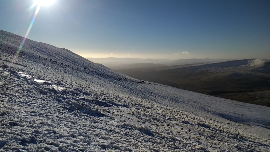 Traffic on "the motorway" up Pen y Fan! 2. The route up from the Pont ar Daf carpark is nicknamed 'The Motorway' for good reason! I assumed it meant it was a well-trodden path on which you should expect to see other hikers. What I didn't expect was the long line of people in front and behind us. It was like the M25. At rush hour. And bear in mind that this was in the depths of winter, not during the peak of summer (although it was a bank holiday, to be fair). The path was icy and when people slipped or stopped for a rest, the line of hikers behind them literally had to stop and wait. We were in a walking traffic jam! This photo shows the line of hikers skirting around the side of Corn Du.  The Garwnant Visitor Centre is close and a pleasant place to stop by 3. Use the toilets at the Garwnant Visitor Centre. The first stop for me before the start of any hike is the toilets. It's also an absolute must when you have children with you! There is a toilet block in the Pont ar Daf carpark but it was quite unpleasant. The toilets were usable - just about - but the Garwnant Visitor Centre is a 5 mins drive away and there are clean public toilets there during opening hours. There is also a nice cafe here if you want to stop off after your walk for a cup of tea or hot chocolate. 4. There is a great mobile and 3G signal at the top of Pen y Fan. Having worried about whether I would be able to use my phone for geocaching at the top of the mountain, I discovered that I had a good clear signal. That was in stark contrast to the bottom of the mountain where there was no signal whatsoever.  Long queue to prove you made it to the summit! 5. If you want your photo taken in front of the National Trust marker at the top of Pen y Fan, expect to queue. See point 2 about the traffic! On the upside, there are plenty of people who can take your photo for you!
The summit of Pen y Fan sits at 886m above sea level and is the highest point of the Brecon Beacons National Park (and southern Britain). For me, it will always be remembered as Jay's first mountain. It's not as high or impressive as Eve's first mountain (Scafell Pike) but this walk was snow-covered so had its own challenges and triumphs. Before heading out, I researched the best route for kids. I wanted something that was not too difficult or hazardous as Jay was untested on this type of walk and I wasn't sure of his ability. Trawling through the internet, I found some references to 'quite young kids' walking the route from the Pont ar Daf carpark but none described the age or experience of the children involved, so I was unable to compare them with my own children. So, in case it's helpful to know, Jay is 6, Eve is 10 and both are fit and healthy. They are used to low-level walks in the countryside but are not especially sporty individuals.  At the start of the walk (Pont ar Daf) We settled on following the National Trust's circular walk instructions from the Pont ar Daf carpark because it was only meant to take 2.5 hours and, if I'm honest, I was more worried about maintaining Jay's interest in the walk than I was about his physical ability. I figured we could keep him entertained for 2.5 hours on a difficult uphill hike whereas we might struggle on an easy path for 4 hours or more. The original plan was to do the walk on New Years' Day but the weather was horrendous! There was snow and sleet, and the icy particles blowing in your face was like being stabbed by tiny spikes. A teeny bit of me thought it might be fun and exciting to hike up a mountain in that weather - like we were polar explorers! - but the larger part of me agreed with the rest of the family that it was probably a daft idea. Besides, we wouldn't get any decent views from the top with weather like that. Fortunately the weather the following day was gloriously clear. Unfortunately the snow on the path from the previous day had been trampled by so many hikers that it had turned into an icy sheet. The path itself is not terribly steep or difficult but the surface was so slippery that most people (and there were a lot of people!) decided to walk on the side of the path instead. The snow was ankle deep here and quite hard work, and I spent a lot of timing longing for my other walking stick, which I had left in the car. The one I did bring was initially commandeered by Jay for the purposes of prodding icy patches and, when he was bored of that, I lent it to Eve who needed help staying upright. I think we ended up on our bums a total of 8 times as a family, which is actually not that bad considering the conditions! It took twice as long as it was supposed to but we eventually made it to the top of Pen y Fan, where we joined the long line of other hikers for the obligatory photo with the National Trust's summit marker. The next part of our route was supposed to take in the summit of Corn Du but given I had descended part of Pen y Fan on my backside - unintentionally, to start with, before deciding to was actually a pretty good way down - I didn't want to climb anymore unnecessary peaks that we would then also have to descend. At this point, Jay was feeling a bit miserable from falling over so we skirted around the side of Corn Du and found a spot to hide under our bothy for lunch. I'm sure we looked completely mad as it was neither raining nor were we in a survival situation but it's amazing what the novelty of sitting under a big piece of plastic will do for kids' morale! The rest of our journey was easier, less icy and mostly uneventful but with pretty stunning views. It's much easier to appreciate the scenery when you are not constantly worried about falling over! In the end, any difficulty with the hike was mostly down to the snow and I wouldn't have any concerns about our kids walking this route again. I imagine it is far easier and faster during the summer. Our planned 2.5 hours walk ended up taking 4.5 hours, including lunch. I'm glad to say that Eve and Jay completed it without too much trouble or grumbling (although we did bribe Jay at times with a handful of Maoam sweets!). We finished in good spirits and with a sense of satisfaction from having completed our most demanding hike as a family, proving to me that we are now able to head out on more challenging adventures together. Hooray!  Corn Du and Pen y Fan A lovely card and poem by Eve (written in advance of our trip to the Brecon Beacons).  Us (the 4 Adventurers),
On a journey to a peak, Travelling through any weather, Damp, cold, rainy or bleak. Trying to beat our travel bug, And the little blue tit (May), Around the 15 National Parks, In 1 year (hooray!!!). One of the highlights of our trip to the Brecon Beacons was staying in a camping pod at the YHA Brecon Beacons. We wanted an inexpensive place to stay that offered self-catering facilities and flexible booking dates. Looking into the YHA seemed the obvious option as they have hostels in all the places we plan to visit this year and, from previous experience, have good basic facilities in a friendly environment. We were pleasantly surprised to find that some hostels now offer cooked meals and packed lunches as well. We want to cook for ourselves when possible to keep the cost of our travels down but it is always good to have options. Our original plan was to stay in a private room but we were intrigued by the camping pods - often known as 'glamping'. That is a contraction of 'glamorous' and 'camping' and seems a bizarre term as I don't think there is anything glamorous about camping, even if you are staying somewhere unusual like a camping pod, yurt or gypsy caravan! A better name would be 'comfy camping', as you get the fun elements of camping - like cooking over a campfire - but also a warm, comfortable night's sleep. YHA Brecon Beacons has two camping pods, which have been hugely popular since they were installed 9 months ago. They are located a short walk from the main hostel (including down some steps), so a torch is a must for night-time trips to the toilet.  Each pod has a small decking area outside, perfect for leaving your muddy boots or cooking on a camping stove. The plastic chairs would be great for sitting outside on a summer's evening but it was too wet during our trip to make use of them. Inside, the cabin is toasty warm thanks to underfloor heating and has two sleeping sections - one with two single beds and one with a double futon-style bed. I was concerned that the pod would be drafty and cold so we packed sleeping bags but didn't need them at all. What you can't see from these photos is how much storage space there is. There is ample room for bags (and Simon's 5ft long telescope) under the single beds and a wooden box at the foot of the double futon. The pods are well lit and, surprisingly, have four plug and two usb sockets. Bonus!  This particular hostel is in a great location for hiking and only a 5 minute drive to the Pont ar Daf carpark (where we started our hike up Pen y Fan). Combined with the friendly welcome from the reception staff, the clean and tidy cooking and washing facilities in the main building, and the spectacular views of the surrounding mountains, this is definitely a place we would stay at again. The only downside? The patchy phone and 3G signal in the area - but then some would consider being uncontactable an additional bonus!
Sleet and snow forced us to abandon our initial plan to hike up Pen y Fan on New Year's Day so we drove to the nearby Coed Taf Fawr instead, a large area of forest in which I knew several geocaches were hidden. It is situated 5 miles north of Merthyr Tydfil, has some interesting walking trails and a nice Visitor Centre with a cafe and clean public toilets. We parked at the Garwnant Visitor Centre and head straight out to the nearest geocache to drop off May and our Travel Bug. By this time, the sleet had reduced to a mild but persistent drizzle. This was the first time I had geocached in winter weather and the lesson I learned was not to do it again! It is bad enough that caches are very hard to spot once the ground is carpetted in fallen leaves, but having to dig through said leaves when they are wet and muddy was not terribly enjoyable. We poked around with sticks for a while but failed to find either of the first two caches that we were looking for, which was extremely disheartening. As it was now past lunch time, we gave it up as a bad job and hunted down a flat, dryish location in the forest for us to set up our bothy. Here we are, eating our lunch under cover! It was tempting to drop into the cafe instead but given we had brought a packed lunch and the kids were keen to use our bothy properly for the first time, we decided to risk looking completely mad to any passersby walking through the woods. The second lesson I learnt that day was that if you are trying out equipment at home, you need to do it properly. Our lovely bothy, which seemed so spacious when we were trying it in our living room, was actually quite a tight squeeze when we were all dressed in thick coats and had four backpacks in with us. Jay suffered a case of pins and needles in his foot from sitting funny and being squished. Having said originally that our four-man bothy was a touch over-sized for two adults and two children, I am now not entirely sure I would want to share it with three other adults! After we had refuelled, we head back out to look for another geocache. I was getting a bit worried at this point that we might not be able to drop off our Travel Bug at all. We were navigating using the Geocaching app on my phone but my GPS signal was a bit patchy and even once we were in the 'right' spot, we couldn't find the hidden boxes. The only cheering thing was what a nice walk we were having! At this point, the rain had stopped and it was snowing on and off (in the nice way, when the flakes settle on you for a short while and you are reminded of how magical snow is). Also, there are some great sculptures in the forest to discover! 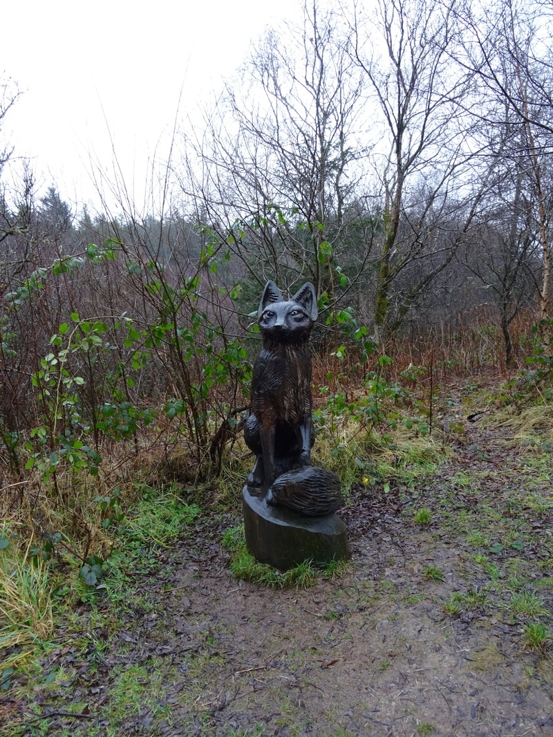 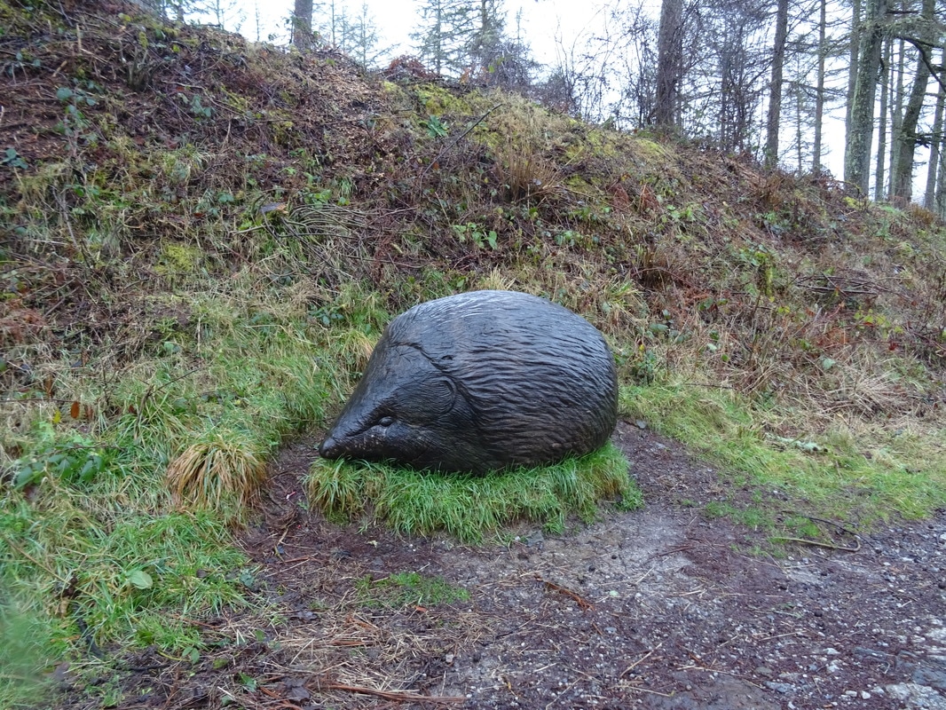  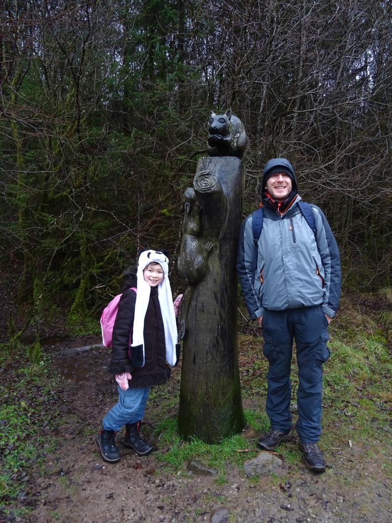 My personal favourite was the mole made out of slabs of welsh slate. Very cool!
So, despite a bit of a disappointing start to the day, we all had fun. We had a laugh in the bothy, went on a memorable walk, enjoyed the feeling of success when we finally found a geocache and wrapped up the afternoon with a hot chocolate in the cafe. What more could we ask for?!
Geocaching is a technology-based activity. Whilst it is possible to navigate to a geocache using a map and compass, it is easier to use a GPS device. Otherwise, if you are a bit off with your navigation and accuracy, you could be searching under many, many rocks and up many, many trees before you finally stumble across the geocache. When we started geocaching several years ago, we bought a Garmin eTrex GPS but unfortunately, on getting it out recently, we were dismayed to discover the batteries had leaked and the device no longer turned on. OK, our bad. I know you’re supposed to take batteries out of devices that you aren’t using but in our defence, when we last put the GPS away, we didn’t know it would be the last time in years! It was expensive so I am a bit irritated. After a bit of a clean and some fresh batteries, the GPS turned on briefly but then died again. So, what to do now…we have a Travel Bug to drop off but no GPS to navigate us to a geocache.
We have been considering our options… Option 1: buy a new GPS. Definitely the easiest but also the most expensive option – upwards of £100. Option 2: figure out how to use my smartphone as a GPS. I looked at a lot of free apps but the ones that direct you to a location require a postcode, not map co-ordinates (which is what you are given for the location of the geocache). Other apps tell you what map co-ordinates you are at, not how to get to one. I could pay to use the Premium features of the Geocaching app, which will surely direct us to the geocache we want, but my main concern with Option 2 is how well my phone will work in more remote locations. I’ve struggled to get a conclusive answer on whether mobile phones will give you a proper GPS signal, even if you don’t have a phone or 3G/4G connection. After all, I’m always reading that you shouldn’t rely on your mobile phone for navigation on the mountains and if they were reliable for this purpose, why would £100+ GPS devices continue to exist? And if mobiles can be used as a GPS, can mine (which is a bottom end model)? Option 3: figure out how to input the co-ordinates of a geocache into our Geonaute GPS watch, which is actually designed for runners who want to track their distance travelled, speed and other stats. You can programme in a route but we have only ever done so by plotting rough points on a map, not by inputting specific co-ordinates. We opted for Option 3 in the first instance. Option 1 is too expensive without at least trying the other options first and I am worried about discovering Option 2 doesn’t work once we’re out and it’s too late to do anything else. Unfortunately, after hours of trying, we haven’t managed to upload co-ordinates to the GPS watch. It accepts a gpx file, which we created online using OS Maps, but the file that we generated appears not to work and we can’t work out if the problem lies with its creation in OS Maps or with the GPS watch not being able to read it properly. We are new to OS Maps so it’s not beyond the realms of possibility that we are doing something wrong. On the other hand, the reason the GPS watch was so cheap when we bought it is that it was an end-of-line return, so perhaps it’s broken. Either way, we are not quite sure what to do and still have no solution to our need to find a geocache while we are in the Brecon Beacons. Option 4, which we might have to resort to, is to retreat back to the good old map and compass… One of the activities suggested on the Brecon Beacons National Park's website is geocaching. This is essentially a kind of outdoor treasure hunt: you are given co-ordinates, you track down the location using a GPS, then you search around for the hidden cache. Sometimes this is a plastic tub of little knicknacks (you take one and replace it with something else) and sometimes it is simply a small film canister with a strip of paper for you to record your find. The trickier ones are little containers designed to blend into the surroundings, like a fake rock or pine cone. I have to say, the child in me likes the caches that hold items to trade - those are like finding treasure! An interesting element of geocaching is the use of Trackables, such as a Travel Bug, which is a dog tag with a unique code. You set it a mission, leave it in a cache and hope that other geocachers collect it, move it to another cache and help it to achieve its task. Geocachers log the movements of the Travel Bug on the Geocaching website so that you can track it online.
If you'd like to track her movements, you can visit www.geocaching.com/track/ and use the reference TBKNEK.
(May is named after Simon's late grandmother, who passed away in 2015. She enjoyed birdwatching and the outdoors, and was so incredibly kind and generous towards me. She would have enjoyed hearing about this adventure, so I think it's fitting to have her play a part in it. ) |
Archives
December 2017
Categories
All
|


 RSS Feed
